River Valley News - June 5/26

In This Issue

  • The Untamed River: Torrential spring rain and a riverboat struggles. 

  • Mapping Ancient Roots: A student wins a $100,000 scholarship for tracking Alberta's oldest heritage trees. 

  • Water Council Dissolved: The province axes the 22-year roundtable just as water-intensive AI data centres expand. 

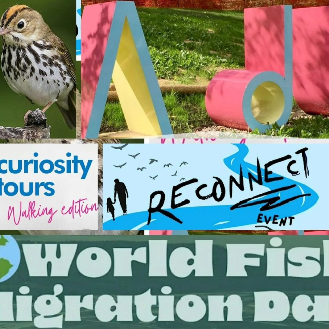
  • Forest Bathing Returns: Edmonton brings back guided nature immersion sessions across local parks this summer. 


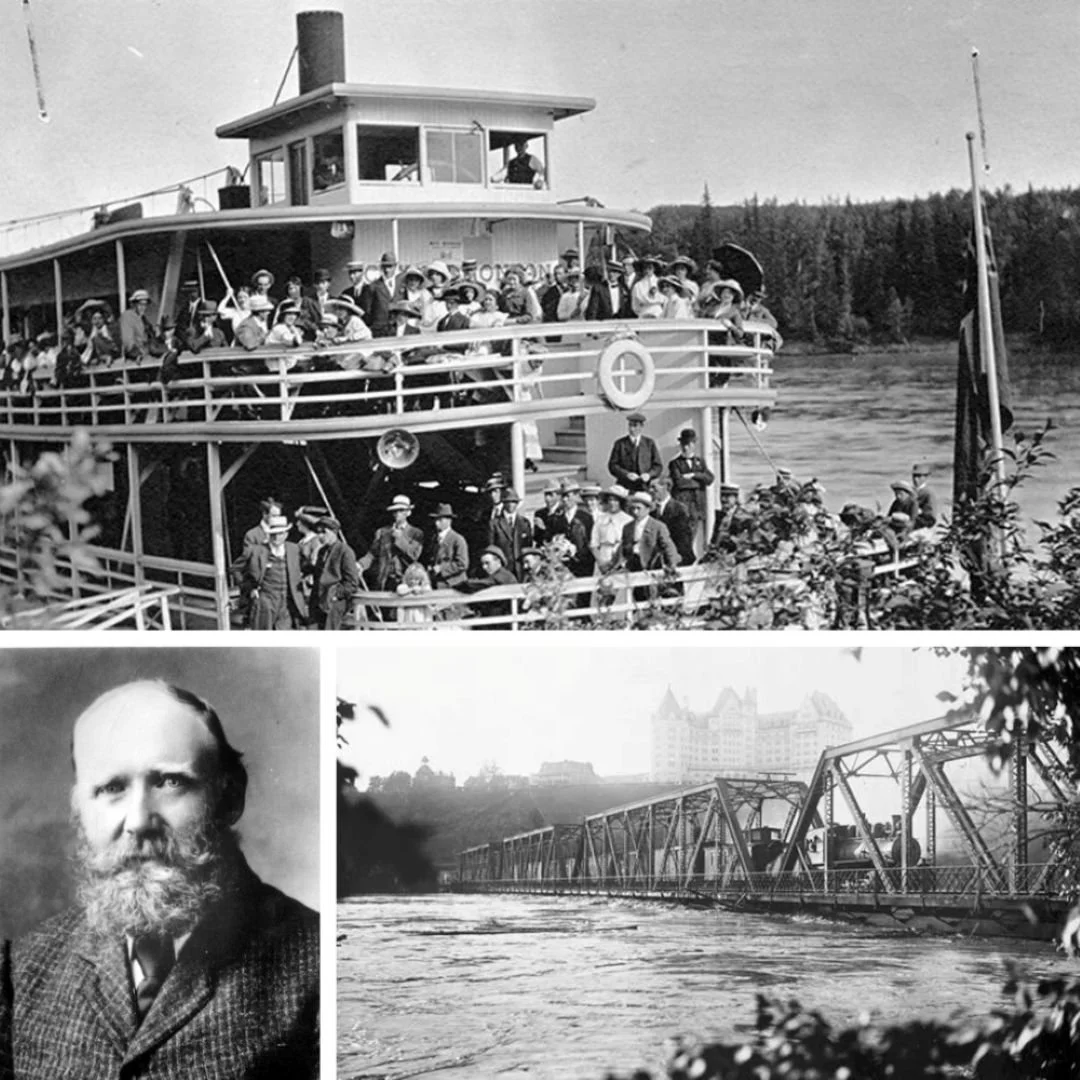
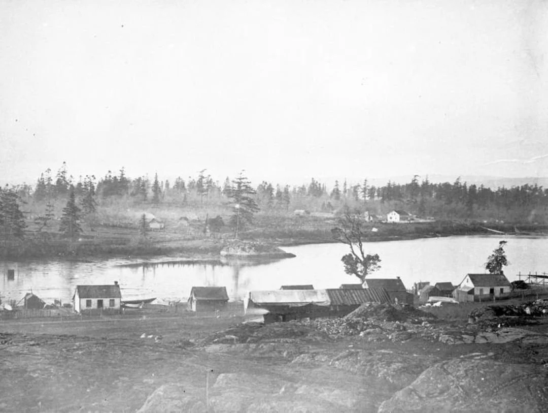
Photo credits: City of Edmonton Archives

Shifting Sandbars, Spring Deluges, and the Timeless Flow of the NSR 

This past weekend, Edmonton got soaked by a spring storm that dumped 75 to 100 mm of rain in just a couple of days, filling basements, flooding yards, and turning river valley trails into soggy detours. It wasn't nearly as devastating as the flood of 1915—when massive mountain snowmelts combined with days of torrential upstream rain, causing the North Saskatchewan to rise a foot per hour and turn Rossdale into a deep lake—but it was a stark reminder of how quickly the river can reclaim the valley when the clouds open up. 

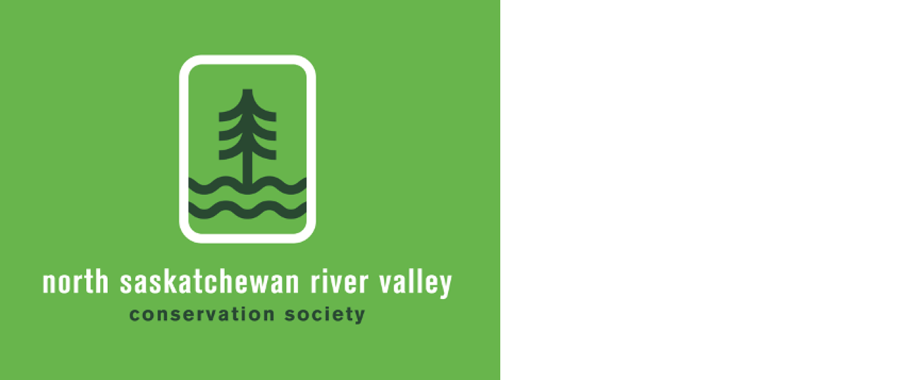
The recent deluges echo another stubborn reminder of the river's character from earlier in May, when the Edmonton Riverboat suffered a hydraulic pump failure during a Mother’s Day cruise. Out of an abundance of caution, the captain deliberately brought the vessel to rest on a gravel bar just south of the James MacDonald Bridge. Around 200 passengers had to be evacuated from a paddlewheeler that suddenly found itself where no brunch-serving boat wants to be: safely beached on the riverbanks. It’s a scene that would have felt completely familiar to John Walter, the Edmonton pioneer whose luxury steamboat the City of Edmonton was famous in the 1910s for getting trapped on the shifting gravel bars that hindered early river transit.

More than a century separates Walter’s era from today’s paddlewheeler, but the North Saskatchewan hasn’t changed its personality. The connection isn’t just historical; it’s literally buried in the riverbed. Just look back to November 1960, when dropping water levels near the Walterdale camp exposed the rotting wooden ribs and rusty spikes of an old pioneer wreck, sparking a massive local debate over whether the river had finally given up the bones of Walter’s City of Edmonton or the Strathcona.

Decades later, heavy rain still turns our paths into temporary rivers, and those same hidden gravel bars still decide when a modern boat is done for the day—and suddenly sneak up on you when you're out for a leisurely paddle. The river doesn’t care about our schedules, our engineering, or our century of progress. It was here long before us, and it will remain long after we've left our mark—a quiet reminder that we don't control the river; it will always have the final say.


Mapping Alberta's Ancient Roots 

Jasper Place High School student Josh Kirsch has earned a prestigious $100,000 Schulich Leader Scholarship, recognizing his remarkable work in combining environmental science with software development. Kirsch secured the premier STEM award for creating Ancient Roots Alberta, a digital platform he built to map, document, and preserve the province's most significant heritage trees.

The project traces its beginnings back to the 2020 pandemic lockdowns. When Kirsch was 12, his school librarian dropped off a selection of books at his house, including one on Canada's historic, giant trees. The book sparked a deep interest that led to six years of independent field research, mapping, and measuring trees across the province. Realizing that Alberta lacked a modern, centralized registry for these specimens, Kirsch spent hundreds of hours teaching himself to code and build the live web platform.

Today, the registry features 374 verified heritage trees, operating as a community-driven project where the public can submit local discoveries, upload field photos, and log geographic data. Kirsch, who heads to the University of Alberta this fall to study forest business management, views the platform as a lifelong commitment. By bridging the gap between digital tools and the physical landscape, the Ancient Roots map provides a living record of the centuries-old giants quietly growing across our river valleys and rural backcountry.


Water Council Dissolved Just as Industrial AI Demands Loom

The Alberta Water Council has officially closed its doors, following a provincial decision to discontinue its core $1-million annual operational grant. Established in 2004 to guide the province's Water for Life strategy, the multi-stakeholder non-profit was given a rapid 90-day window to wind down operations and transition its website into a permanent digital archive. Throughout its two-decade history, the council functioned as a collaborative, consensus-based forum where representatives from industry, environmental groups, Indigenous communities, and government directly negotiated shared policy—famously achieving a voluntary 30% reduction in water use across multiple sectors.

The abruptness of the closure blindsided members. Signing off the final board meeting, professional biologist and founding member Jay White described the 90-day timeline as an "erasure" of decades of hard-won trust. "Collaborative water policy is slow by design," White noted, emphasizing that the council’s strength was its ability to force opposing sides to keep talking. "History rarely marks the moment when stewardship ends. It only records when its absence is finally noticed. Water policy advice is not dramatic. But its absence is."

That absence is being felt immediately as massive, water-intensive industrial projects move forward without a shared oversight table. Most prominent is the proposed Wonder Valley AI data centre campus in the Municipal District of Greenview, spearheaded by O’Leary Digital. The project recently scaled up its public plans to an enormous 9-gigawatt power capacity across a 64-square-kilometre footprint. While developers claim closed-loop cooling designs will limit consumption to under 6 million cubic metres per year, the local municipality has moved to secure a preliminary certificate to withdraw up to 24 million cubic metres annually from the Smoky River watershed. The massive scale of the request has already triggered fierce pushback from local advocates and a formal legal challenge from the Sturgeon Lake Cree Nation over risks to regional agricultural water tables.

Government officials defended the budget cut as a necessary measure to streamline administrative functions, noting that the council's president was a senior government bureaucrat and that the province would instead consult directly with individual watershed groups. However, critics and municipal leaders argue that eliminating the independent roundtable creates a dangerous oversight gap. By replacing a unified, consensus-driven model with fragmented, direct-to-government consultations, the province has dismantled its primary forum for cooperative stewardship—right when high-friction industrial demands are reaching multi-million-cubic-metre highs.


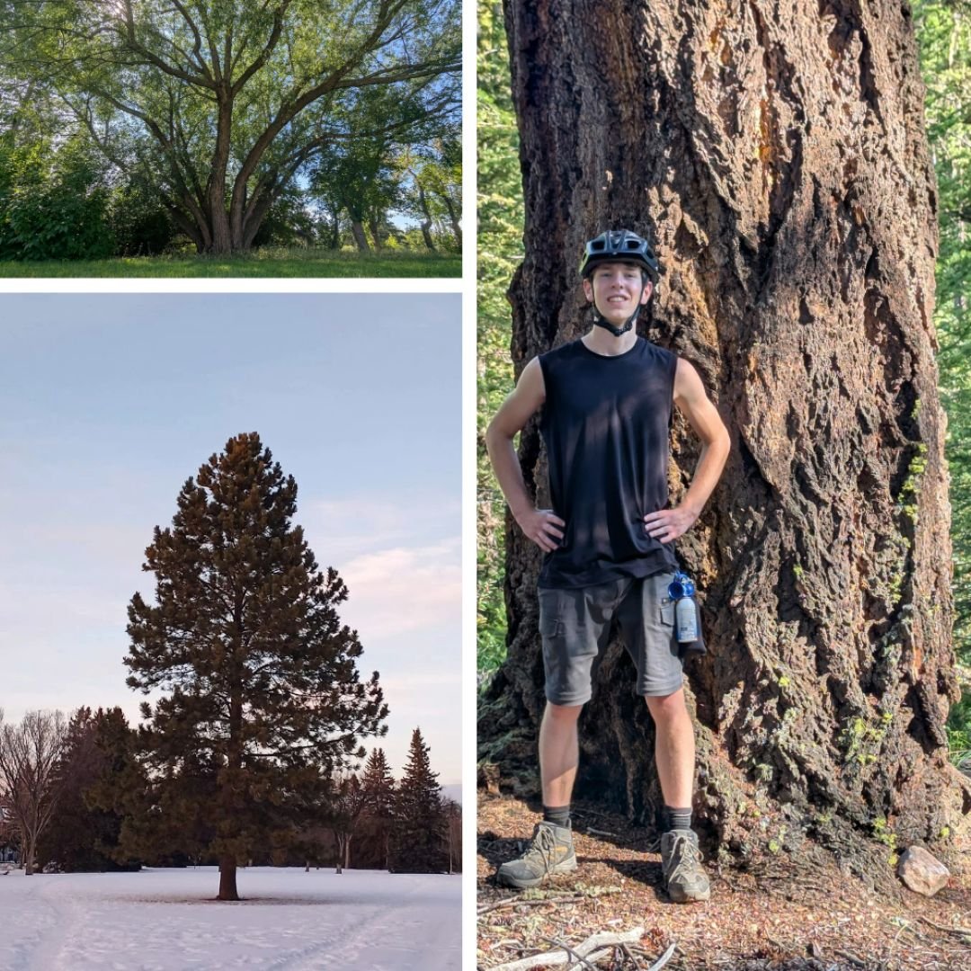
Forest Bathing Returns to Edmonton Parks 

The City of Edmonton is resuming its free, certified shinrin-yoku (forest bathing) program this season, offering structured nature immersion sessions coordinated by the municipality's Urban Forestry team. Originating in Japan, the practice prioritizes slow-paced, mindful sensory engagement over physical exertion to reduce physiological stress markers, stabilize mood, and support overall well-being. Participants are guided through specific exercises designed to anchor attention on immediate environmental stimuli, such as ambient sounds, visual patterns in the canopy, and natural textures.

The two-hour instructor-led sessions are being offered as distinct registered courses through the summer, featuring specific themes including "Immunity Boost" and "Nature Reconnection." The itineraries integrate silent meditation, exploratory walking, and intervals for individual reflection within designated municipal green spaces. The 2026 program locations feature a variety of local parks and natural areas, including Northeast River Valley Park, Whitemud Ravine, Capilano Park, and the Twin Brooks District and Nature Park, as well as collaborative sessions held at the Larch Sanctuary in partnership with the Edmonton and Area Land Trust.

To find summer dates, park schedules, and registration info, head to the city's Move.Learn.Play portal under Registered Programs. You can also check program details and locations at edmonton.ca/ForestBathing


Misi-mîkisak // Cheyenne Rain LeGrande ᑭᒥᐘᐣ // 2026 // Hawrelak park


Comment or Contributions

Please note that articles may not reflect the position of NSRVCS. River Valley News is meant to be a clearinghouse for the variety of opinions and ideas about Edmonton’s River Valley.

Email river valley photos, event information, comments, or questions to nsrivervalley@gmail.com.

Forward this link to anyone you think may want to sign up for this newsletter https://www.edmontonrivervalley.org/newsletter-signup

River Valley News - May 21/26

In This Issue

  • Spring Event Calendar: Six local gatherings, workshops, and guided trail walks from May 23 to June 11.

  • The "Prairie Chicken" Mystery: Spotting the difference between native grouse and urban partridges.

  • A FireSmart River Valley: Inside Edmonton's newly finalized wildfire mitigation and prevention strategy.

  • The Lore of the Lobstick: Traditional trail markers and the upcoming historical monument project.

  • Art Feature: Stream the NSWA’s complete history series.

Explore and Connect with Our River Valley

Get ready to head outdoors! May and June are packed with opportunities to explore the North Saskatchewan River Valley, learn about local ecology, and contribute to conservation efforts. Here are six upcoming events to add to your calendar:

World Fish Migration Day: We are River People Saturday, May 23 | 1:00 PM – 3:00 PM Join the Touch Grass Club and the Beyond the River team at 10298 89 St NW to celebrate the life within our waters. This family-friendly afternoon features hands-on water quality testing, stories of the river, and insights into the challenges facing local fish populations. Kids can enjoy fish-themed crafts, games, and even decorate their own fish sugar cookie to take home.

Where the Ovenbird Sings Sunday, May 24 | 1:30 PM – 4:30 PM Explore Edmonton’s largest old-growth forest at Lady Flower Gardens (20303 33 St NE). This event, co-hosted by the Edmonton River Valley Conservation Coalition, offers five expert-guided synchronous walks through the New Jubilee Forest. Whether you’re interested in bats, birds, or old-growth ecology, or simply want to enjoy a spring afternoon by the yurt with light snacks and drinks, it’s a perfect way to connect with the landscape.

Art, Story & Circle: An Indigenous Art Park Gathering  Sunday, May 31 | 11:00 AM – 1:00 PM Join the River Valley Alliance's Indigenous Committee for a guided gathering at ᐄᓃᐤ (ÎNÎW) River Lot 11∞ Indigenous Art Park (10380 Queen Elizabeth Park Rd). Meeting under the gazebo by the parking lot, participants will move between various art installations. Led by community members and Elder Lance, the gathering features shared teachings, storytelling, spoken word, and poetry rooted in the land and creative reflection. Be sure to arrive 15 minutes early so the circle can begin on time.

Reconnect Event: To the Land and One Another Sunday, June 7 | 12:30 PM – 4:30 PM Celebrate Environment Week at the Alfred H. Savage Centre (13909 Fox Dr NW) with an incredible coalition of local groups, including SCAN! Edmonton, For Our Kids, ERVCC, and the Touch Grass Club. This massive community gathering features a mix of indoor and outdoor activities: drumming, singing, and a round dance with the River Cree Singers; storytelling and guided nature walks; native seed and seedling sales; and even a hands-on workshop for building DIY air filters for air quality. The Dawg Gone It food truck will be on-site, and the event runs rain or shine.

ECAMP Curiosity Walking Tours: Strikes, Struggles, and Success Various Dates The Edmonton City as Museum Project (ECAMP) is hosting a series of walking tours that dive into the social and industrial history of our city. These tours explore the hidden stories behind Edmonton’s landmarks, focusing on the people and movements that shaped the community we live in today. Keep an eye on their schedule for specific meeting locations and times.

Biodiversity Day with Nature Alberta & Root for Trees  Thursday, June 11 | 5:30 PM – 8:30 PM Head down to Rundle Park for an evening dedicated to local biodiversity. This event features a rotating schedule of three 30-minute workshops: a community science nature walk, a tree-planting workshop, and an invasive weed-pulling session. "The Mule" from The Columbian will be onsite serving free coffee and tea (bring your own reusable mug!), and there is even a plant giveaway for participants. Note: If weather forces a cancellation, the event will move to Friday, June 12.


The Mystery of the “Prairie Chicken” 

If you have spent any time exploring the fields, coulees, or even urban hedges around Edmonton, chances are you have heard someone point out a bird and call it a "prairie chicken." The reality? There hasn't been a true Greater or Lesser Prairie-Chicken (Tympanuchus genus) in Alberta for decades, as they have been completely extirpated (locally extinct) from Western Canada due to habitat loss. Because the real thing vanished from our landscape, the nickname "prairie chicken" has been casually transferred by generations of locals and hunters to several completely different species of upland game birds, creating a classic case of prairie mistaken identity.

The bird most frequently saddled with this moniker is the native Sharp-tailed Grouse (Tympanuchus phasianellus), which shares the same genus and grassland habitat as the true prairie-chicken. While they look similar at a glance, you can spot the difference by looking at their bellies: Sharp-tails feature distinct V-shaped chevron markings and pointed tail feathers, whereas true prairie-chickens have horizontal, zebra-like barring and square tails. Unfortunately, our provincial emblem bird is facing its own modern struggles; while not officially listed as a species at risk across all of Canada, localized habitat fragmentation and the loss of native prairie grasslands have put significant pressure on their traditional breeding grounds (leks), making the preservation of intact open spaces more critical than ever for their survival.

So, what are those plump, round birds you actually see wandering through Edmonton’s suburban neighbourhoods, city parks, and rail corridors? Those are almost certainly Gray Partridges (Perdix perdix), commonly known as Hungarian Partridges or "Huns." Introduced from Europe in the early 1900s, these resilient little birds are about the size of a small football—roughly half the size of a grouse.  They are easily identified by their bright orange-rust faces, fine gray body feathers, and the dark, horseshoe-shaped patch on their bellies. Unlike our native grouse, Huns have adapted beautifully to urban and agricultural spaces, sticking together in tight family groups called coveys that suddenly "explode" out of the brush when startled.


Photo credit: Leo Cruzat, CityNews

Proactive Steps for a FireSmart River Valley 

Encompassing over 7,400 hectares of connected natural space and 160 kilometres of maintained trails, Edmonton’s "Ribbon of Green" stands proudly as the largest urban parkland system in Canada. However, our changing climate—marked by repeated hot, dry, and windy conditions—means this continuous wilderness winding through our city also brings a heightened risk of wildfire.  To protect our natural ecosystems and the neighbourhoods bordering them, the City of Edmonton recently finalized its proactive Wildland-Urban Interface Wildfire Risk Strategy. This strategy shifts the focus from simply reacting to fires to actively preventing them before they start, recognizing that every dollar invested in wildfire preparedness saves significantly more in future community and economic stability.

The strategy is built on four core pillars: reducing ignition risks, strengthening emergency response, expanding public education, and regional coordination. To tackle built-up fuel loads, Edmontonians will see expanded vegetation management, including targeted trailside debris clearing, understory thinning, and a specialized grassland fuel management program to establish permanent and seasonal fire breaks. The City is also leaning into modern technology and traditional practices; this includes expanding its automated smoke-detecting sensor network, running high-risk daily drone surveillance, and utilizing controlled, prescribed fires—such as recent burns in local parks—which safely reduce brush while promoting ecological regeneration.

Building a resilient city requires a collective effort, and residents play a vital role. Property owners can take advantage of FireSmart landscaping guides to transition yard spaces toward drought- and fire-resistant vegetation, and neighbourhoods can band together under the FireSmart Neighbourhood Recognition Program. On the landscape, the City urges all trail users to follow local fire bans, use only authorized fire pits, and strictly refrain from smoking in naturalized or vegetation-covered areas. If you are looking to kickstart a local resilience project, the City's Community Climate Adaptation Micro Grants are a great place to start. Most importantly, if you ever spot smoke or an active fire in the river valley, call 911 immediately to ensure a rapid response.


Photo credit: “The Sentinel” by Merle Massie
The Lore of the Lobstick 

Following up on our look at Leon Hunter's piece from the last newsletter on the historic Victoria Trail, the Victoria Home Guard Historical Society is looking ahead to its next major initiative: the development of the Lobstick Monument Project. This new interpretive installation is inspired by traditional trail markers used by Indigenous peoples and early travellers along the historic corridor. A traditional lobstick (derived from the Cree word lopstick) was a conspicuous navigation marker created by pruning the middle and lower branches of a tall pine or spruce tree, leaving a distinct tuft of foliage right at the very top. As noted in historical research published by Active History, these markers were intentionally crafted from the tallest, most prominent trees on a ridge or riverbend. Visible from miles away across flat terrain and along vital waterways, they served as an indispensable geographical reference system for Voyagers, fur traders, and hunters travelling the vast wilderness networks of Western Canada, as documented by the Virtual Museum of Métis History and Culture.

Beyond their practical use as wilderness signposts, lobsticks carried a deeply personal and cultural significance. Creating a lobstick was a communal act of honour; a tree was typically chosen and sculpted to commemorate a specific historical event, seal a treaty, mark an important hunting ground, or pay tribute to an esteemed traveller. The process was celebrated by those present with a small gathering, a shared story, and sometimes a salute of gunfire, permanently bonding that person's name or the event to the physical landscape. While the practice eventually faded with the arrival of steamships, railways, and modern highways, it remains a powerful historical example of investing deep cultural memory directly into living geography, ensuring that important milestones remained visible and meaningful for generations to come.


"A River Runs Through Us" Mini-Doc Series

Explore the deep history, industrial recovery, and modern conservation of our local watershed by streaming the educational multi-part series, “A River Runs Through Us - The North Saskatchewan River,” produced by the North Saskatchewan Watershed Alliance. Every segment of this impactful documentary is now fully available to watch for free on the official North Saskatchewan Watershed Alliance YouTube Channel.


Comment or Contributions

Please note that articles may not reflect the position of NSRVCS. River Valley News is meant to be a clearinghouse for the variety of opinions and ideas about Edmonton’s River Valley.

Email river valley photos, event information, comments, or questions to nsrivervalley@gmail.com.

Forward this link to anyone you think may want to sign up for this newsletter https://www.edmontonrivervalley.org/newsletter-signup

River Valley News - Apr 18/26

In This Issue

  • Springing to Life: The bird count returns to Big Lake.

  • Victoria Trail: Leon Hunter explores a historical corridor through time.

  • A Legacy at Risk: Debating the future of Alberta's "protected" lands.

  • Jane’s Walk YEG: Passing the torch to a new home at ECAMP.

  • Get Involved: Join the global City Nature Challenge this month.


Bird Count Returns to Big Lake

The Big Lake Environment Support Society (BLESS) is officially bringing back a community favourite this month. For the first time since 2018, the Springing to Life bird count will return to the BLESS observation platform on April 18 and 25. This event is a vital tool for tracking spring migration patterns and understanding how local avian populations are shifting. Interestingly, this year’s count has already yielded a rare sighting: a pair of Wood Ducks was spotted at the platform on April 9, marking a first for the organization’s records. The public is warmly invited to visit the platform between 10 a.m. and noon on both days to use high-powered scopes and learn about local species from experienced bird-watchers.

The platform is situated within Lois Hole Centennial Provincial Park, a site of global significance designated as an Important Bird and Biodiversity Area (IBA). Serving as a critical stopover for over 235 species, the park honours the legacy of the late Lois Hole—Alberta’s 15th Lieutenant Governor, a beloved gardener and a fierce advocate for the environment. Her namesake park protects the fragile shoreline of Big Lake, ensuring this "green lung" remains a sanctuary for wildlife. To reach the viewing platform directly, the most convenient access is via the Lois Hole Centennial Provincial Park parking lot at the intersection of Ray Gibbon Drive and LeClair Way, followed by a short walk along the Boardwalk Trail. Alternatively, visitors can park at Rotary Park in Riel Recreation Park and enjoy a longer, scenic walk along the Red Willow Trail System to reach the lake.


Preserving the Victoria Trail: A Corridor Through Time

By Leon Hunter

Along the banks of the North Saskatchewan River lies the Victoria District, one of Alberta’s most historically rich cultural landscapes. Anchored by the historic Victoria Trail, this corridor served as a vital route for Indigenous peoples, Métis families, and early settlers, eventually connecting Winnipeg to Edmonton. Today, this legacy is preserved by the Victoria Home Guard Historical Society (VHGHS), whose dedicated efforts helped secure the district’s designation as a National Historic Site of Canada in 2002.

The district functions as an accessible, open-air museum featuring a network of sites that tell Alberta’s early story, from the Pakan Ferry Crossing to the Victoria Settlement. Notable landmarks include early grist mills, Ukrainian settlement areas, and Métis Crossing, which remains a major center for cultural learning. Through volunteer leadership, the VHGHS has installed interpretive signage and restored key locations like the Victoria Park Cemetery to ensure these stories remain accessible for future generations.

The society continues to transform the landscape by creating monuments, such as the Red River Cart and the RCMP Memorial, and is currently focused on its next major initiative: the development of the Lobstick Monument. This work demonstrates how community leadership can preserve both landscape and legacy, and the VHGHS warmly welcomes new members and supporters to join their mission. For more information or to offer support, please contact Don Klym at 780-656-2114 (eastklym@mcsnet.ca) or by mail at Box 28, Warspite, AB T0A 3N0.


The Battle for Alberta’s "Protected" Lands

The Government of Canada recently unveiled "A Force of Nature," a sweeping strategy backed by a $3.8 billion investment to protect 30% of Canada’s lands and waters by 2030. This federal push aims to curb biodiversity loss by establishing more robust national parks and Indigenous-led conservation areas. However, a significant disagreement has emerged regarding what counts as "protected" land within our province. While the Alberta government suggests that current public land management already meets these targets, the Canadian Parks and Wilderness Society (CPAWS) has labelled these claims "misleading," noting that many of these areas remain open to industrial activities such as logging and mining.

As CPAWS Northern Alberta Executive Director Kecia Kerr recently emphasized, "You can't meet conservation targets by simply redefining what 'protected' means." This sentiment is echoed by Dr. Justina Ray, President of WCS Canada, who reminds us that "we all need nature"—not just as a luxury, but as a fundamental necessity for survival. These natural areas have taken thousands of years to reach their current state of complexity and balance; they are not merely scenery, but ancient biological systems functioning as the life-support for our entire region. 

By failing to protect them completely, we are effectively withdrawing from a biological "bank account" that may seem limitless today, but will prove devastatingly costly to future generations. Scientific research into ecosystem services confirms that intact wild spaces provide essential functions like water purification and carbon sequestration that are nearly impossible to replicate once lost. When we prioritize short-term extraction over long-term preservation, we risk a "tipping point" where these ancient systems can no longer sustain the biodiversity we all depend upon.


Jane’s Walk YEG: Passing the Torch to ECAMP

After 16 years of grassroots organizing, the founders of Jane’s Walk Edmonton are officially handing the festival's leadership to the Edmonton City As a Museum Project (ECAMP). This transition ensures that the beloved tradition of community-led walking tours will have a sustainable, long-term home within our city's heritage framework. By joining forces with ECAMP, the walks will benefit from formal administrative support while maintaining the local, storytelling spirit that Jane Jacobs famously championed.

The festival officially kicks off on May 1 and continues to encourage citizens to share personal observations and hidden histories of their own neighborhoods. This year’s diverse schedule features a variety of unique perspectives, including a bike tour exploring the sustainability of Blatchford and heritage walks through Westmount. These tours offer a perfect opportunity for residents to reconnect with the architectural history and the many hidden gems that define our urban landscape.

The shift to a museum-led project aims to preserve the authentic, "unfiltered" voice of Edmontonians while providing better resources for volunteer walk leaders. Organizers believe that placing the program under the ECAMP umbrella will help reach new audiences who are eager to explore the city's evolving cultural identity. Whether you are a long-time resident or a newcomer, these walks remain one of the best ways to discover the deep-rooted stories that make our communities unique.


City Nature Challenge

Become a community scientist this month! Join the global City Nature Challenge from April 24–27 by using the iNaturalist app to document local wildlife and plants. Your observations help track Edmonton's biodiversity and contribute to vital conservation research.


Comment or Contributions

Please note that articles may not reflect the position of NSRVCS. River Valley News is meant to be a clearinghouse for the variety of opinions and ideas about Edmonton’s River Valley.

Email river valley photos, event information, comments, or questions to nsrivervalley@gmail.com.

Forward this link to anyone you think may want to sign up for this newsletter https://www.edmontonrivervalley.org/newsletter-signup